Sunday 27 July 2008

Forge Valley, Hackness Walk (27 July 2008)


Posted by Picasa


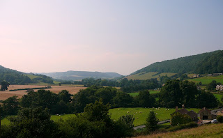
Probably the hottest day of the year so far saw me heading for the nearest chunk of the North York Moors National Park – Forge Valley.

I parked at West Ayton, a village about three miles west of Scarborough. I saved the path by Ayton Castle for the return leg, to use the higher way along the top of the western side of the valley. The path runs pleasantly above the steep valley, dipping into the edge of the wood.

Rather than constantly referring to the map I used my preferred method of scanning the route at the start of the walk and keeping the map in the rucksack for occasional reference at points of doubt. The problem with this approach is that it is easy to be beguiled by clear well-used paths which wander off the intended right of way. And so I was…

Forge Valley is a National Nature Reserve and furnished with tracks off the established rights of way. I happily wandered along one such track before realising my mistake. Not to worry, there were other, wilder and narrower ways, one furnished, initially, with duck boarding, heading in my intended direction.

The next half mile took the best part of an hour. I traversed the steep, in places precipitous, side of the valley, constantly deviating around fallen trees and branches, patches of deep mire and loose, muddy and unstable ground. It was an entertaining interlude in the hot, humid air, beset by voracious insects intent on feasting on my now bloody arms. It was a training walk after all.

I eventually rejoined the main track and continued on a more sedate course towards Hackness, passing the idyllic hamlet of Wrench Green. The Derwent valley, from the river’s source by the Fylingdales Early Warning station, to Forge Valley, is probably my favourite Moor’s dale and certainly one of the area’s most scenic.

After flirting with the river for a short while I took the path high behind Hackness Mere and Hall. I sat for a while with my boots off, socks steaming, munching a banana and apple, making a fine contrast to the pampered souls lounging in the gardens of the house below.

After dropping down to the valley bottom at Hackness, the path annoyingly climbs through a narrow, tree-lined gully, to regain the considerable lost height. Near the top a large tree had recently dropped, blocking further progress along the path: another inelegant jostle, up, over and round the obstacle ensued before gaining the hill top.

The path down to Mowthorpe Farm is a delight, dropping down through more woods and pasture to the road. There is no real alternative but to use the lane back to Forge Valley, but it is quiet and in magnificent surroundings. It is hard to believe that Scarborough, no doubt heaving on a hot summer Sunday, is only two or three miles to the east.

After a mile or so the lane is abandoned and the river is crossed by a footbridge to take an easy duck-boarded path downstream, through the woods, passing Ayton Castle, back to the village and car.

The walk was about ten miles long. It was much more demanding than I’d intended because of the heat and the adventure in the woods, but highly enjoyable nonetheless. Apart from the valley bottom path at Forge Valley, where there were strollers aplenty, I didn’t see another walker all day.

Wednesday 23 July 2008

Flamborough Head (20 July 2008)


I stayed local today.I really must get up earlier n a Sunday morning. A short run in the car took me out to Flamborough for an afternoon saunter around the headland. Th coast paths are popular with plenty of options to vary the route.

I took the path from the village to North Cliff along a path that runs for a distance along the edge of a large static caravan site. The path is pleasant enough, shielded for the most part from the caravans. Unfortunately, its other function is as a venue for the campers to empty their dogs. There are no constipated pouches in these parts...

It was a day that alternated between heavy, cold showers and hot sunshine: chilly and drenched one moment, hot and sweaty the next. Despite the unsettled weather there were plenty of people walking and bird watching on the cliffs.

It's been a year or two since I was last on this part of the headland. Erosion has eaten into the cliff causing some path diversions, particularly near to Thornwick Bay and on the approach to Danes Dyke further south.

Both North landing and and Flamborough Head were busy with car-borne visitors. Fortunately the bulk of tourists tend not to wander too far from the car parks or beach, concentrating the litter near to the roads.

In addition to the golf coarse, beach, cliffs, bar and cafes Flamborough Head boasts two lighthouses, one dating from the mid seventeenth century, the other from the early nineteenth. The new lighthouse can be visited at times and is well worth the climb up to the light.

South of the lighthouse the foot traffic thinned considerably, with only occasional hikers and sea birds for company. I had a couple of sightings of gannets from the colony up the coast at Bempton.

South Landing provides an early escape back to the village, partly along a lane. A better, but slightly more energetic, option is the path, a little bit further south, at Beacon Hill. I continued a another long half-mile further south to Danes Dyke, forsaking the cliff for the woods. The path passes an ancient earthwork, which extends across the headland and gives its name to the otherwise natural ravine of Danes Dyke.

The path from the Dyke to Flamborough was once attractive. At first it follows a field edge, then enters an old pasture before decamping onto a lane in the village. The path over the pasture is now channelled through a barbed wire enclosed passage. Electric fences further carve up the field into enclosures for pigs and horses. An ugly, partly constructed, agricultural building, with an associated access track, also adorns the field.

I do not understand why such desecration is sanctioned on agricultural land, without discussion or appeal, when any development in the adjoining village is, quite properly, subject to close scrutiny. If the culprit is subsidised in any way by my taxes, I want my money back.

Although the coast isn't my preferred walking venue, I enjoyed another good hike of about ten miles, with plenty of short, sharp ascents. It did not present any problems or difficulties.

Tuesday 22 July 2008

Firefox v Internet Explorer

Why does Internet Explorer make such a hash of things? After setting up a simple blog page, consisting of a few photos and a bit of text, the resulting masterpiece displays well enough in Firefox, but is completely mangled in Internet Explorer.

I'd be grateful to anyone who would point me in the right direction to fix the problem. In the meantime, if you really want to see Flamborough Head walk in all its multi-media glory, use Firefox (IE is a load of >expletive deleted< anyway!).

Sunday 13 July 2008

Wharrem Percy - Thixendale Circular (13 July 2008)

Because of the appalling recent weather and some other commitments, it’s been a couple of weeks since I was last able to get out for a walk. Not to worry, only moderate showers were forecast today. The plan was to rise early, park at Wharrem Percy by nine and to be back at home in time for a late lunch. It didn’t quite work out that way: the ample consolation for a noon start was listening to a rerun of an edition of “I'm Sorry I Haven't a Clue” on the drive over.

I was lucky to find a space at the small Wharrem Percy car park. The scant remains of the medieval village were attracting plenty of visitors on what was now a very pleasant day. I left the modest throng and headed up a lane for a short distance before joining a bridleway along a ridge.

Faced with alternative paths I left the main route, for no better reason than it avoided retracing my steps for half a mile on the return leg. I’d never used the path before but, whilst it was clear enough on the ground, it was a bit overgrown and took a rather roundabout course.

A couple of tracks in the vicinity look like they’ve been diverted in the past, probably to preserve the privacy of a large farm, Raisthorpe Manor. As is frequently the case when an often ancient way is abandoned, the resulting diversion cuts across the grain of the land and is never quite as pleasing as the natural route. I’m sure a route could have been devised which avoided the environs of the farm building, whilst retaining the integrity of the way. Still, the residents of Raisthorpe Manor are spared the sight of occasional plebs.

The high Wolds are an extremely attractive part of Yorkshire, largely unknown outside the area, and, even on a sunny Sunday afternoon, the paths were unfrequented. Thixendale was positively humming with people, however; there was an open gardens event in full swing. The village isn’t pretty, but is full of character and has a terrific setting. Although I only popped in for a soft drink, the pub’s pretty good too…

The remaining route back to the car was along the Yorkshire Wolds Way and begins with a steep pull back onto the tops. As befits its National Trail status a few more walkers were now in evidence. Fortunately, none were about when I performed my party piece. It could have been the walking poles, or the long grass, or simply tripping over my own feet. Whatever the cause, I dived headlong, greeting the earth with a Glasgow Kiss – the bruise is developing nicely.

The Wharrem Percy Medieval Village site was moderately busy with visitors. The old fish ponds and the ruined church sit in a scenic little valley, surrounded by the humps and bumps of the abandoned settlement. It takes a leap of the imagination beyond my admittedly limited abilities to visualise life here in the fifteenth century.

And so back to the car after a grand walk of about nine miles without any foot or stamina problems. I must get up earlier next Sunday though…